Case study — Claire Urban, with D-Sight
A way through Belgian urban planning law.
An AI-native platform that turns thousands of overlapping municipal, regional, and federal planning rules into a usable answer for a specific parcel of land.
The problem.
Belgium has 566 municipalities across three regulatory regions — Brussels, Wallonia, Flanders — each with its own urban planning frameworks layered on top of national rules. Working out which rules apply to a specific plot of land means cross-referencing geographic zones, municipal codes, and regional frameworks. In practice that is manual, slow, and error-prone, whether you are a citizen, an architect, a notary, or a municipal officer reviewing a permit.
D-Sight — a Belgian firm working at the intersection of urban planning and law — saw the opportunity to make that knowledge accessible by turning their domain expertise into a product, rather than billing it by the hour to one client at a time.
What we built.
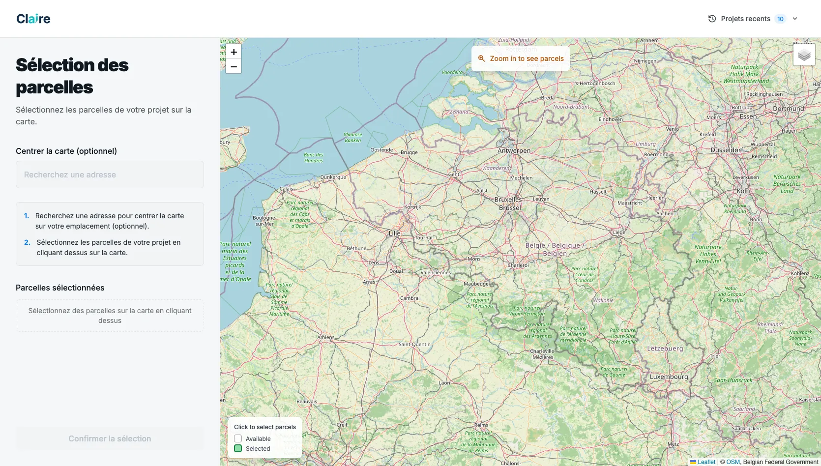
Claire Urban is one platform with three faces: a public planner where anyone can pick a parcel on a map and get AI-generated regulatory advice for a project they describe in plain language; a professional workspace for permit dossiers, from creation through public inquiry to decision; and an admin layer for managing the rulebook, syncing geographic layers, and onboarding municipalities.
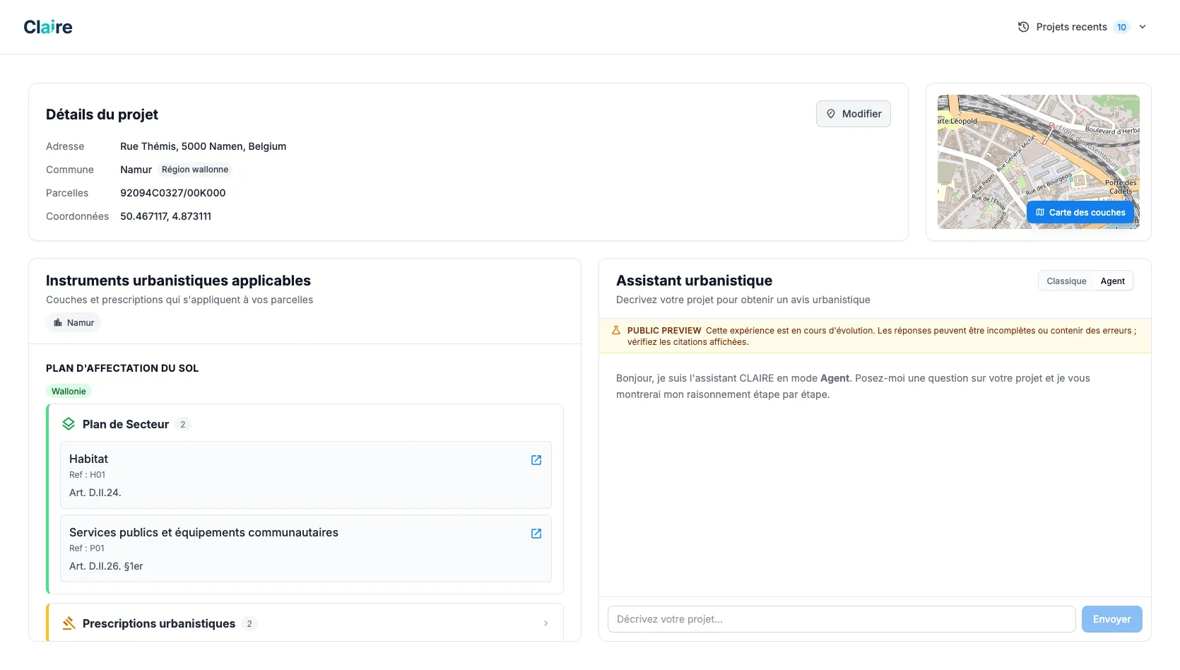
Underneath, the AI does the work that legal staff used to do by hand: it breaks a project description into sub-questions, finds the relevant rules using a mix of semantic search, full-text matching, and spatial intersection against the parcel, then synthesizes an answer in the client's professional voice rather than inventing one. Every answer is anchored to the specific regulatory instruments that apply to that parcel — visible side-by-side with the AI's reasoning, so nothing is taken on faith.
On the professional side, incoming permit documents are parsed by the same AI stack for permit type, applicant details, and referenced parcels — the dossier is half-populated before staff open it.
We designed and built the platform end to end — architecture, all three applications, the AI retrieval and generation pipeline, the geospatial data ingestion, the infrastructure, the deployment.
Why it was hard.
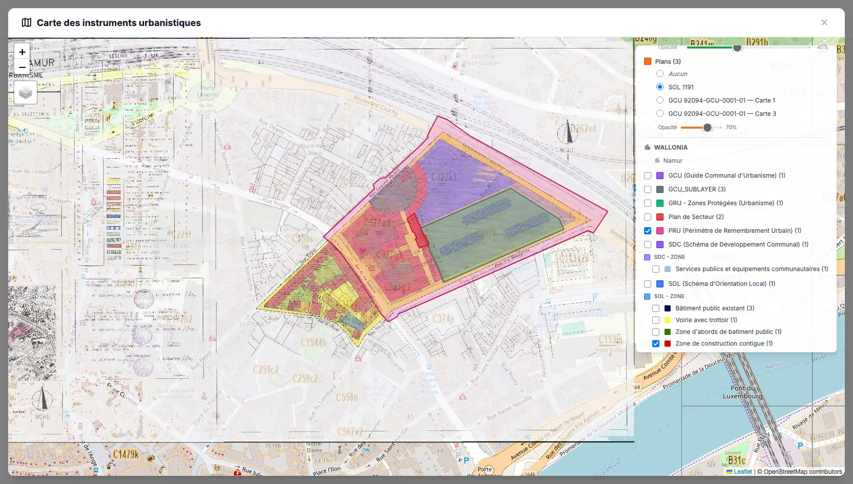
Three problems collided. The first is geospatial: every rule needs to be tied to a place, and "a place" can be a municipality, a zoning layer, a heritage perimeter, or an arbitrary polygon drawn on a map. Around fifty distinct regulatory instrument types can be in play at once, depending on the parcel — data that sits in different coordinate systems, comes from different government feeds, and updates on its own schedule.
The second is AI quality. In a legal-adjacent product, a confidently wrong answer is worse than no answer. The retrieval pipeline had to be transparent about which rules informed an answer, and the generation step had to be tuned to defer rather than invent when the source rules don't actually cover the question.
The third is the professional workflow. A permit dossier in Belgium passes through opinions, public inquiries, derogations, conditions, and rulings — each with their own legal weight and history requirements. Modelling that faithfully, while keeping the UI usable, was a domain modelling problem before it was a software one.
The outcome.
A live, production platform covering all 566 Belgian municipalities, with parcel-level geometry, thousands of indexed urban planning rules across the three regions, and the full permit dossier lifecycle. Used by professionals inside the firm and being rolled out to municipal and professional partners.
The client now has a product that scales their expertise far beyond what an hourly model could ever reach — and one that gives ordinary applicants a way in that didn't exist before.
Engagement.
Open Studio. Delivered as a sustained engagement over several months — product engineering, AI architecture, geospatial data work, infrastructure, deployment.
Have a knowledge-heavy domain?
Turning expert work into product is what we do. AI, geospatial, regulated industries — we've shipped in all three.
Let's talkLean builders. We deliver.